
Bought Deals in Gold: How Institutional Capital Is Returning
June 8, 2026
Off-Take Agreements: Europe’s Commodity Reserves as a Financing Anchor
June 8, 2026
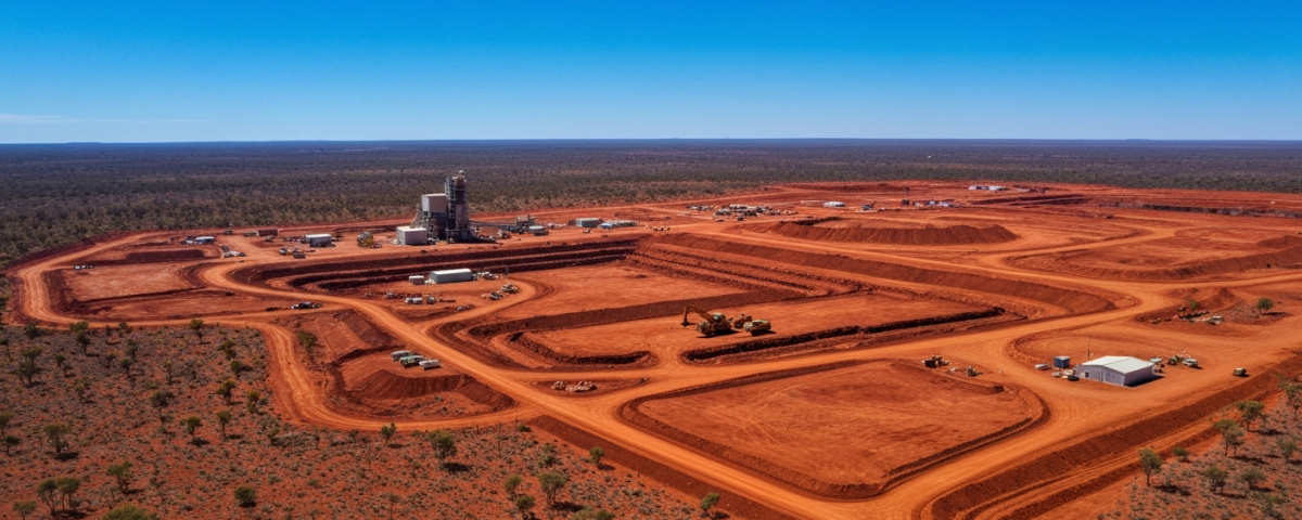
Mapping before drilling: The principle behind airborne surveys
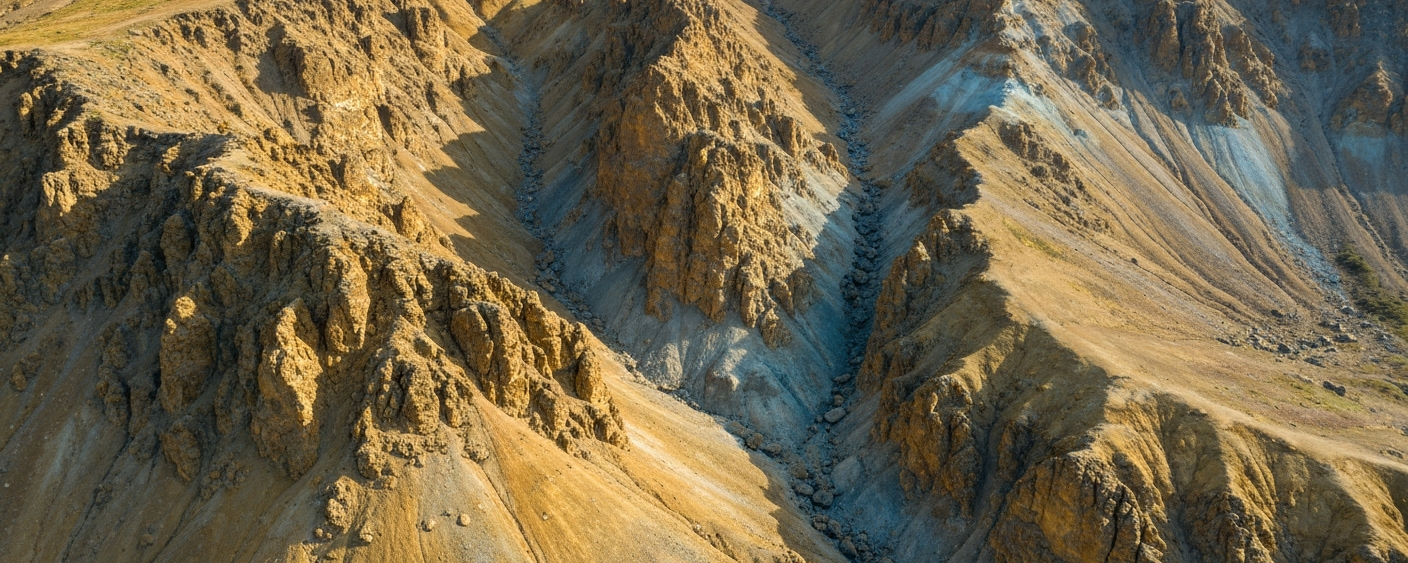
Anyone watching gold exploration tends to picture drill rigs, drill cores, and grades in grams per tonne. But before a drill string enters the ground, there is a phase that often goes unnoticed: the systematic aerial investigation of geology. Airborne surveys — aircraft-based geophysical measurements — let small exploration companies structure large land packages before drilling begins.
In North America, such programs are currently underway across several regions. In the Cassiar District in northern British Columbia, a junior explorer has extended its high-resolution airborne program to more than 2,200 line-kilometres. New Brunswick and the Yukon have similar campaigns running. For newcomers, immediate questions follow: What does such a program measure? Why fly first and drill later? How does geophysics influence the strategy of a small-cap company?
What aircraft reveal about gold — and what they don’t
An airborne survey does not detect gold atoms. Instead, it captures physical properties of rock that can indirectly point to mineral systems. In gold exploration, three main methods dominate:
- Magnetometry: Measures variations in the Earth’s magnetic field caused by magnetic minerals such as magnetite. Intrusive bodies, fault zones, and hydrothermal alteration produce characteristic magnetic signatures.
- Electromagnetics (EM): Measures electrical conductivity of the subsurface. Sulfide minerals like pyrite and pyrrhotite conduct electricity well and often occur in gold-bearing systems.
- Radiometry: Measures natural radiation from potassium, uranium, and thorium. It distinguishes different rock types and maps alteration zones.
These methods combined produce maps where geological structures become visible that are nearly impossible to detect at the surface. A program covering 2,000 line-kilometres means the aircraft flies that distance in parallel passes over the land package — typically spaced 50 to 200 metres apart. Tighter line spacing yields higher resolution and more precise anomaly definition.
Capital efficiency as a strategic argument
For junior explorers with limited capital, the sequence of exploration steps determines whether the company survives. A drill hole costs between 150 and more than 500 euros per metre, depending on depth, geology, and remoteness. A 500-metre hole quickly consumes 250,000 euros without delivering actionable results.
An airborne survey covering the same area often costs a fraction of that and delivers a structured picture allowing the geology team to test the most promising zones first. This is target prioritization: decisions are made on a data-driven basis, directing capital to where it generates the greatest gain in geological knowledge rather than drilling everywhere at once.
Consider searching for sunken treasure in a lake. You could dive randomly — or deploy a sonar device that maps the lake bed and identifies several areas with elevated reflectivity. You then dive at three precise locations instead of thirty. Airborne surveys work the same way for gold exploration.
| Exploration Step | Typical Cost | Knowledge Gained |
|---|---|---|
| Airborne Survey (per km²) | Low to moderate | Structural map, anomaly distribution |
| Ground Geochemistry (sampling) | Moderate | Element concentrations, pathfinder trends |
| First-Pass Drilling | High | Lithology, initial grades |
| Infill Drilling Program | Very high | Resource definition (NI 43-101) |
From anomaly to drill target: Working through the data
A current example from New Brunswick shows how this works in practice. A junior explorer deployed district-scale geophysics to define a corridor system between two known gold occurrences. The magnetometry data revealed a structural connection suggesting possible gold-hosted mineralization zones — something surface reconnaissance alone could not have uncovered. The result was a prioritized target area for the next drilling campaign.
Similar logic applies in the Yukon, where several companies are using their land packages for systematic geophysics before defining new resources or expanding existing ones. The approach of understanding the ground first makes particular sense in the Yukon’s fragmented terrain, where surface outcrops are sparse and glacial overburden obscures signals.
For investors, this has concrete implications. When a company announces an airborne program, it is in an early, data-gathering phase. That is not a setback — it is methodologically sound. Investors might view it as an indicator of disciplined capital management, especially when the program leads to a clearly defined drilling strategy.
What geophysical data reveals about a project’s maturity
From a market perspective, assessing project maturity requires understanding the exploration steps already completed. A company wrapping up an airborne program stands at the beginning of the cycle. That means high potential but also high uncertainty. A company that has translated airborne data into drill targets and recorded initial intercepts operates at a different risk level.
The current trend toward district-scale surveys — programs covering entire geological corridors rather than isolated known zones — signals methodological maturation within the industry. Instead of individual drill holes without an overarching geological model, more companies adopt a structured “picture first, drill later” approach. This does not eliminate exploration risk, but it raises the probability that deployed capital will translate into actionable geological knowledge.
An airborne survey is not a stock market catalyst in the traditional sense. It is an investment in geological evidence, and that evidence determines how well-founded the next expensive decisions will be.
Key technical terms at a glance
- Airborne Survey
- An aircraft-based geophysical measurement of a land package. It measures physical properties of the subsurface (magnetism, conductivity, radioactivity) to map geological structures from the air.
- Line-Kilometres
- The unit of measurement for the scope of an airborne survey. It indicates the total length of all flight lines flown. More line-kilometres over a given area yields higher resolution.
- Anomaly
- A deviation in a geophysical measurement that points to a geological feature of interest. An anomaly may — but does not necessarily — indicate economic mineralization.
- Magnetometry
- Measurement of variations in the Earth’s magnetic field. It identifies magnetic rock bodies, fault zones, and hydrothermal alteration zones — common structural companions of gold mineralization.
- Target Prioritization
- The data-driven process of selecting and ranking drill targets, concentrating available drilling capital on the most promising anomalies.
- NI 43-101
- The Canadian standard for reporting mineral resources and reserves. Resources (Inferred, Indicated, Measured) and reserves (Probable, Proven) are strictly separate categories and must not be used interchangeably.
- First-Pass Drilling
- Initial drilling at a previously untested target. It delivers fundamental geological information about lithology and possible grades, but does not yet form the basis for resource estimates.
- District-Scale Exploration
- An exploration strategy that examines entire geological systems across large land corridors rather than just individual known targets, enabling identification of unknown mineralization zones within a broader geological framework.
⚠️ Important notice: This article is for informational and educational purposes only. It does not constitute investment advice, a recommendation, or a solicitation to buy or sell any security. Investments in small-cap exploration and mining companies carry a high risk, including the potential total loss of capital. Before making any investment decision, consult a registered financial advisor and conduct your own analysis. Boersen Post Team is not responsible for decisions taken based on the content published here.
