
Airborne Survey Methodology: What Geophysics Does Before REE Drilling
June 17, 2026
Marine SMR Reactors: Why Radiation-Hardened Chips Are the Key Component
June 17, 2026
When software reads the terrain before a drill bit touches ground
For decades, exploration was painstaking craft: geologists mapped rock formations on foot, interpreted anomalies from aerial surveys by hand, and made drilling decisions on accumulated experience and gut instinct. It was expensive, error-prone, and, measured by success rates, often sobering. The uranium sector is now going through a genuine methodological shift — algorithms are increasingly taking over what the industry calls target generation, the systematic identification of areas with an elevated probability of mineralization. The consequences reach from the drill site all the way to the capital markets.
Reports from the Australian junior mining space mention companies applying AI-generated exploration targets to uranium projects in under-explored basins, though none name those companies specifically. That makes any firm assessment difficult. The technical approach itself is clear enough, however: computing power and machine learning, long confined to data centers and consumer products, are now appearing at the earliest stages of the commodities supply chain.
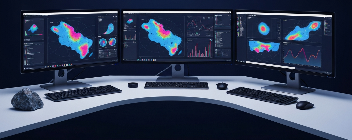
Multiple data layers, evaluated simultaneously
How does AI-assisted target generation actually work? Such a system processes multiple data layers at once — layers that a human team would typically evaluate one at a time, and often in isolation:
- Geophysical data: Magnetic, gravity, and electromagnetic measurements from aerial surveys provide indications of subsurface structures — faults, contact zones, and conductive layers.
- Geochemical data: Sample analyses from soil, sediment, or rock reveal local elemental anomalies that may point to deeper-lying mineralization.
- Historical drilling data: Old drill cores and assay results from previous campaigns, some decades old, are digitized and fed into the model.
A trained model can detect patterns in these datasets that aren’t immediately visible to a geologist reviewing each layer in turn. Subtle spatial correlations between geophysical anomalies and known uranium occurrences in comparable geological settings, for instance. The output is a probability map with prioritized drill targets.

Cost risk for junior miners
For small-cap investors, the real issue is the cost structure. A single drill hole in remote terrain — mobilization, crew, and lab analysis included — can run between AUD 500,000 and several million dollars depending on depth and jurisdiction. For a junior miner with limited cash, every unsuccessful drill hole is more than just a setback.
This is where the AI approach has something to offer. If a model learns from hundreds of historical data points which geological signatures have actually led to uranium mineralization, it can improve target selection. Fewer dry holes mean less capital consumed before the first resource is confirmed.
A simple numerical example: if you select from 100 possible drill locations with no analytical filter and strike mineralization in five of them, you pay for 95 failed attempts. A well-trained model built on thousands of historical locations could push that rate to 15 or 20. The value of a discovery does not change — but the cost of reaching it falls significantly.
| Exploration method | Strength | Weakness |
|---|---|---|
| Traditional geological mapping | Depth of detail, local expert knowledge | Slow, subjective, scales poorly |
| Geophysical surveys (airborne) | Broad coverage, objective raw data | Interpretation requires experience |
| AI-assisted target generation | Pattern recognition across multiple data layers | Dependent on data quality and volume; model output is a hypothesis |
Semiconductors in the background
The infrastructure behind this trend deserves a closer look. Geological AI models run on GPUs and AI accelerators built by a small group of semiconductor companies. Demand for that computing power is growing not only in language models and consumer applications, but in industrial niches like commodity exploration too.
The connection is indirect but real. A junior explorer deploying AI sources its computing power through cloud services or locally installed specialized hardware. Both paths lead back to the same semiconductor supply chains. A technology originally developed for entirely different purposes is now delivering measurable economic value in what looks like an unrelated sector, and in commodity exploration that process is still relatively recent.
Limits that no model can compute away
AI-assisted target generation has real limitations that investors should understand, and none of them disappear because the software is sophisticated.
- Garbage in, garbage out: Algorithms are only as good as their input data. Incomplete historical records, inaccurate coordinates for older drill cores, or non-standardized assay protocols significantly degrade model quality.
- Unexplored ground remains unexplored: In basins where little historical data exists, a model has minimal training foundation. At best, the AI can draw on analogous areas, with correspondingly higher uncertainty.
- The permit decides: Even the most precise AI-generated target is worthless without a permit in hand. Regulatory timelines, indigenous land rights, and environmental requirements are hard constraints that no algorithm can resolve.
For small-cap investors, this means a company using AI in target generation is working with current methods. That matters. But jurisdiction risk, cash position, and management track record still determine outcomes, as does the quality of the underlying geology. None of that changes because the target list was generated by a model rather than a team of geologists with field notebooks.
Key terms on the topic
- Target generation
- The systematic process of identifying drill target areas on the basis of geological, geophysical, and geochemical data, prior to the first physical drill hole.
- Machine learning (ML)
- A branch of artificial intelligence in which algorithms learn patterns from large datasets without being explicitly programmed. The foundation of modern AI-driven exploration software.
- Inferred resource
- The lowest recognized resource category under NI 43-101 and JORC; based on limited sampling points with moderate geological confidence. Not equivalent to a reserve.
- Assay
- A laboratory analysis of a rock or sediment sample that quantifies the grade and type of minerals present. The basis of every resource estimate.
- Enabling technology
- A technology that originates in one sector and enables new applications and efficiency gains in others — here: semiconductor computing power as the foundation for AI in commodity exploration.
- Geophysical survey
- A systematic measurement of the physical properties of the subsurface (magnetics, gravity, electromagnetics) from the air or on the ground, used to map structures and anomalies.
- Garbage in, garbage out (GIGO)
- A computing principle: poor or incomplete input data will inevitably produce poor model outputs, regardless of algorithm quality.
⚠️ Important notice: This article is for informational and educational purposes only. It does not constitute investment advice, a recommendation, or a solicitation to buy or sell any security. Investments in small-cap exploration and mining companies carry a high risk, including the potential total loss of capital. Before making any investment decision, consult a registered financial advisor and conduct your own analysis. Boersen Post Team is not responsible for decisions taken based on the content published here.


