VMS Systems and Outcrop Mapping: Two Paths to Copper Mineralization
September 1, 2026
Land Package Growth in Copper Juniors: Two Paths, One Goal
September 1, 2026
When data draw a map of the subsurface
Copper is no longer just an industrial metal. Power grid expansion and rising electric vehicle demand will require new supply for decades, and small exploration companies are out looking for it worldwide. Before the first drill turns, there is a phase of systematic knowledge-building: geological information must be pulled together into a model coherent enough to stake capital on.
How a company handles that phase says a great deal about how professionally it operates. In British Columbia, one of Canada’s most mining-friendly jurisdictions, several such processes are currently active. Integrated 3D geological models are being finalized, deep drill holes are going down beneath high-chargeability geophysical anomalies, and successful zone intercepts are prompting expanded drilling programs. Investors who understand this workflow can read junior company press releases with considerably more precision.
From anomaly to drill target
Exploration is not random. Through step-by-step data collection, teams narrow a large project area down to specific targets worth drilling.
Remote sensing and geophysics: The area is surveyed first, from the air or the ground. In porphyry copper systems (broadly distributed ore deposits formed at depth), Induced Polarization (IP) methods work particularly well for identifying chargeability anomalies. High subsurface chargeability points to sulfide mineralization, meaning sulfur-bearing ore minerals such as chalcopyrite, the most important copper-bearing mineral in porphyry systems.
Integrated 3D geological model: When raw geophysical data, geochemistry, mapping results, and historical drill data are combined in a single computer model, a three-dimensional picture of the subsurface takes shape. The model allows anomalies to be located in space, potential ore bodies to be projected, and drill paths to be optimized. It does not prove a deposit exists, but it gives teams a defensible basis for deciding where to drill next.
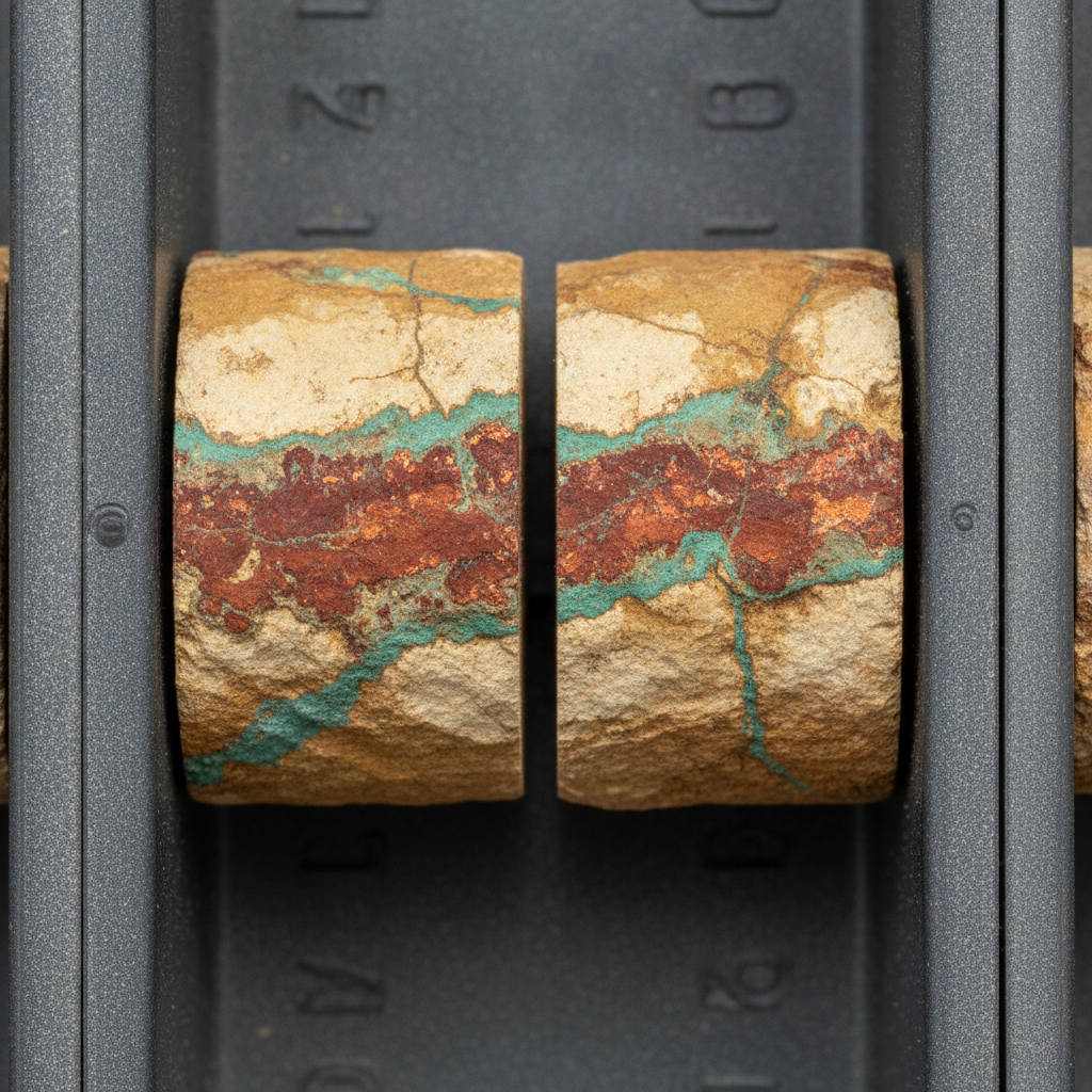
Drill core validation: Drilling begins only once the model is sufficiently compelling. The first hole beneath a new anomaly is a first-pass test with an open outcome. If the core intersects porphyry copper mineralization, the hypothesis holds. If mineralization is absent, the hole still produces data for the next model update.
Why markets react to early-stage data releases
Why do markets react at all to announcements about 3D models or first-pass drill holes, and why do those reactions vary so widely? The answer lies in how junior miners are valued at this stage.
Buying probability, not metal: A junior without a drilled resource is essentially a bet on future discoveries. The 3D model raises the probability of a discovery, but only the probability. Investors who buy into juniors at this stage are buying exactly that upside. The more internally consistent the model, the lower the perceived technical uncertainty, and so potentially the smaller the risk discount built into the share price.
What a first drill hit actually signals: When a deep hole beneath a chargeability anomaly intersects porphyry copper mineralization for the first time, it shows two things: the anomaly was real, and the geological model had genuine predictive power. That builds confidence in the team and in the remaining targets. A first-time confirmation carries more weight than a repeat hit in a known area, because it shows the model works rather than simply that a deposit is larger than expected.
Program expansion as an indirect signal: When a company expands its drilling program after zone successes, management has been convinced by internal results and capital is available. Expansions often anticipate assay data not yet public, which can provide price support during liquid phases of the small-cap market.
| Development Step | Information Content | Degree of Uncertainty |
|---|---|---|
| Geophysical Anomaly | Possible sulfide mineralization | Very high |
| Integrated 3D Model | Spatial target hypothesis | High |
| First Drill Hole with Mineralization | Confirmation that anomaly is real | Medium |
| Multiple Drill Holes with Assays | First resource estimate possible | Medium to low |
| NI 43-101 Resource (Inferred) | Quantified estimate, independently verified | Low (relatively) |
What this means in practice
The process described here is not unique to any individual company. It is the standard pathway for copper exploration in porphyry provinces such as British Columbia, Chile, or Peru.
A 3D model alone does not drill any copper. A chargeability anomaly is not an ore body. Porphyry mineralization in a drill core is not a resource. That may sound deflating, but it is the standard that geologists and capital markets professionals actually apply to early-stage reports. Companies that blur those distinctions in their communications deserve a second look before capital follows.
Porphyry systems contain some of the world’s largest copper deposits. Whether an exploration project fails or becomes a Tier 1 discovery often comes down to how consistently a team works from the first anomaly through to a resource, step by step, without cutting corners on the model or the data.
Anyone following small-cap copper juniors should keep one practical question in mind: where on this path does the company currently stand, and what does the next step actually cost?
Key terms in copper exploration
- Porphyry system
- A magmatically driven ore deposit in which copper (and often molybdenum, gold, or silver) is broadly distributed throughout a large rock body. Porphyry deposits are among the largest copper sources in the world by volume.
- Induced Polarization (IP)
- A geophysical survey method that measures electrical charge effects in the subsurface. Sulfide minerals such as chalcopyrite produce characteristic chargeability signals that can indicate potential ore mineralization.
- Chargeability anomaly
- An area in the subsurface with unusually high electrical charge storage capacity. In copper projects, it is regarded as an indicator of sulfide mineralization, not as proof.
- Integrated 3D geological model
- A digital spatial model of the subsurface that combines geophysics, geochemistry, drill data, and geological mapping. It is the planning basis for drilling programs and for visualizing potential ore bodies.
- NI 43-101
- The Canadian regulatory standard for the disclosure of mineral resources and reserves. Resources are classified as Inferred, Indicated, and Measured; reserves as Probable and Proven. These categories are not interchangeable and must not be used as synonyms.
- Inferred Resource
- The lowest resource category under NI 43-101. The estimate rests on limited data and carries the highest geological uncertainty. An Inferred Resource is not a reserve and cannot form the basis of a feasibility study.
- First-pass drill
- The first drill hole sunk beneath a previously undrilled anomaly or into a new target area. The outcome is open-ended; the primary value is hypothesis testing and generating data for the geological model.
⚠️ Important notice: This article is for informational and educational purposes only. It does not constitute investment advice, a recommendation, or a solicitation to buy or sell any security. Investments in small-cap exploration and mining companies carry a high risk, including the potential total loss of capital. Before making any investment decision, consult a registered financial advisor and conduct your own analysis. Boersen Post Team is not responsible for decisions taken based on the content published here.